Mahardi Setyoso Pratomo
Geospatial Solution & Product Specialist
An operations leader who codes — turning map products, IoT fleets and messy location data into programs that ship and get adopted.
- SQL
- Python
- PostGIS
- H3
- Looker Studio
- Streamlit
- GCP

// QUICK STATS
- years in location data
- 8+
- GrabMaps adoption
- 85–90%
- IoT safety dashcams
- 1,500+
- unmet demand surfaced
- $81.6M
// 01 — KEY ACHIEVEMENTS
Impact, in numbers
// 02 — EXPERIENCE · 06°12′S 106°49′E
Eight years on the map
Grab Holdings
2018 – 2026
Jakarta, Indonesia
Senior Geospatial Product Operations
Apr 2023 – Jun 2026
- Led a team of up to 10 operations specialists including direct reports, owning resource planning, workload allocation, coaching, and delivery accountability across a regional portfolio.
- Served as project-management PIC across all running Map Ops programs, building the trackers, templates, dashboards, and documentation that 5 concurrent impactful initiatives depended on: safety dashcam deployment, FoodLocker deployment, street-level imagery collection, schema database improvement, and indoor navigation.
┌ KEY RESULTS
- ▸ Deployed 1,500+ IoT safety dashcams nationwide, enabling detection of 20+ road safety incidents and training 30+ community driver-partners.
- ▸ Deployed and maintained 200+ IoT FoodLocker devices at >90% utilization, reducing driver action time 25–40%.
- ▸ Sustained >95% quality-control scores across Thailand and Myanmar projects.
- ▸ Contributed 500,000+ km of 360 degree street imagery across 50+ cities, coordinating 70+ gig driver-partners within budget.
Geospatial Product Operations
Mar 2018 – Apr 2023
- Coordinated GrabMaps geo-product launches (Special POI, Routing, Indoor Navigation, location campaigns) and on-ground support, capturing customer and cross-functional issues, root-causing them, and proposing market-fit redesigns to Product and Engineering.
- Managed data-informed launch sequencing during Grab's migration off Google services, prioritizing rollout order to contain adoption risk.
┌ KEY RESULTS
- ▸ Drove GrabMaps adoption from 20–40% at 2022 launch to a stable 85–90% by 2026.
- ▸ Rolled out 200,000+ Special POI entrances/venues and 20 Indoor Navigation sites; sustained 90–95% rollout success and 85–90% booking-point accuracy (internal monthly business reviews).
- ▸ Built the Geohash Extractor automation, cutting a 2-day task to 3–5 minutes, recognized top-5 at an internal Product Ops hackathon.
- ▸ Raised ticket throughput from 12 to 25–30 resolved per day and improved ETA 70–80% in airport, mall, and train-station zones.
- ▸ Restructured Grab geoservices to comply with Badan Informasi Geospasial boundaries, aligning revenue metrics to actual administrative areas.
Datascrip
2016 – 2017
Jakarta, Indonesia
Business Executive (Geospatial & Surveying)
Nov 2016 – Nov 2017
- Drove B2B sales of surveying and geospatial hardware (GNSS, total stations, FARO laser scanning, digital theodolite), building client relationships and tailored solution proposals with principals and partners.
┌ KEY RESULTS
- ▸ Closed a 10-unit theodolite deal (~IDR 70M) and coordinated integrated surveying solutions across sectors.
KLHK (Ministry of Environment & Forestry)
2016
Jakarta, Indonesia
Geospatial Analyst
Jan 2016 – Nov 2016
- Integrated multi-agency spatial data across all 27 Indonesian provinces for the PIPPIB forest-moratorium map; performed overlay analysis, area computation, and attribute pivots; supported karhutla (forest-fire) impact analysis in Riau.
┌ KEY RESULTS
- ▸ Delivered PIPPIB data adopted as a cross-ministry land-use governance reference.
Earthline
2014 – 2015
Jakarta, Indonesia
GIS Assistant & Business Development
Aug 2014 – Nov 2015
- Digitized oil-palm plantation boundaries in ArcGIS; estimated mapping AOIs and converted area measurements into commercial quotes for satellite imagery and mapping services.
┌ KEY RESULTS
- ▸ Supported B2B quotes valued IDR 300M–1B for clients including Sinarmas, Wilmar, and Pertamina.
// 03 — SELECTED PROJECTS
Built, shipped, verifiable
- 01
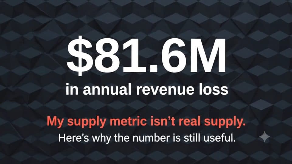
$81.6M UNMET DEMAND
NYC Taxi Supply-Demand Gap Analysis
Seven-component GCP pipeline over 35M+ validated trips and 185 zones; PostGIS spatial validation showed that dispatch, not road access, was the bottleneck behind $81.6M in unmet demand.
// IMPACT
- trips
- 35M+
- zones
- 185
- ADRs
- 56
- GCS
- Dataproc
- PySpark
- BigQuery
- dbt
- PostGIS
- H3
- Kestra
- Terraform
- Streamlit
- 02
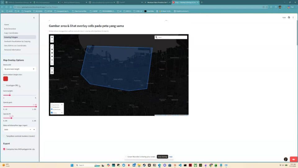
2 DAYS → 3–5 MIN
Geohash Schema Automation Extractor
Self-service Python and Streamlit tool, still in production, that lets non-geospatial teams extract geohash schemas from map polygons without GIS skills.
- Python
- Streamlit
- Geohash
- 03
3 DATA-SENSITIVITY TIERS · 9 REJECTED ALTERNATIVES
Maritime Oil Spill Detection & Investigation — Solution Design
End-to-end solution design for a national maritime authority scenario: architecture, detection and investigation workflows, WebGIS wireframes, sizing, licensing, and nine rejected alternatives.
- Solution design
- C4
- WebGIS
// 04 — SKILLS & GROWTH
Stack and trajectory
DATA & QUERY
- SQL
- PrestoSQL / Trino
- Python
- Spatial SQL
- Databricks
- Hive Data Lake
GEOSPATIAL
- QGIS
- ArcGIS
- PostGIS
- H3
- Geohash
- OpenStreetMap (POI, Routing, Geofence)
- GeoPandas
AUTOMATION & BI
- Google Apps Script
- Looker Studio
- Apache Superset
- Power BI
- Streamlit
- Advanced Spreadsheet Modeling
DATA ENGINEERING (PORTFOLIO)
- GCP (BigQuery, Dataproc, Cloud Storage)
- dbt
- Kestra
- Terraform
- PySpark
- Docker
- Git
AI TOOLING
- Claude
- ChatGPT
- Gemini
- Prompt Engineering
- AI-Assisted Development
PROJECT & COLLABORATION
- Notion
- Trello
- Jira
- Confluence
- Google Workspace
BUSINESS — STRATEGY & DELIVERY
- Strategic planning
- Roadmap prioritization
- Trade-off analysis
- Root cause analysis
- Project portfolio management
- Timeline & budget estimation
- Delivery cadence
- Go-to-market sequencing
BUSINESS — PEOPLE & STAKEHOLDERS
- Team leadership (up to 10)
- Direct-report management
- Coaching
- Requirements gathering
- Solution design
- B2B partnership
- Vendor management
- Budget ownership
- QA/QC
LANGUAGES
- Bahasa Indonesia (native)
- English (professional working)
// 05 — EDUCATION & CERTIFICATIONS
Credentials
EDUCATION
B.Sc. Geographic Information Science
Universitas Gadjah Mada (UGM)
Minor: Statistics & Programming
CERTIFICATIONS
Certified Associate in Project Management (CAPM)
// Project Management Institute · May 2023
CERTIFICATIONS
Big Data Analytics using PySpark
// Algoritma Data Science School · Feb 2025
CERTIFICATIONS
Data Science Academy Full Stack (Data Visualization, Machine Learning, Data Analytics)
// Algoritma Data Science School · Oct 2020
// 06 — CONTACT
Let's map it out
Open to geospatial solution, product operations and solution engineering roles across Southeast Asia and remote.